EMMA: the situation at a glance
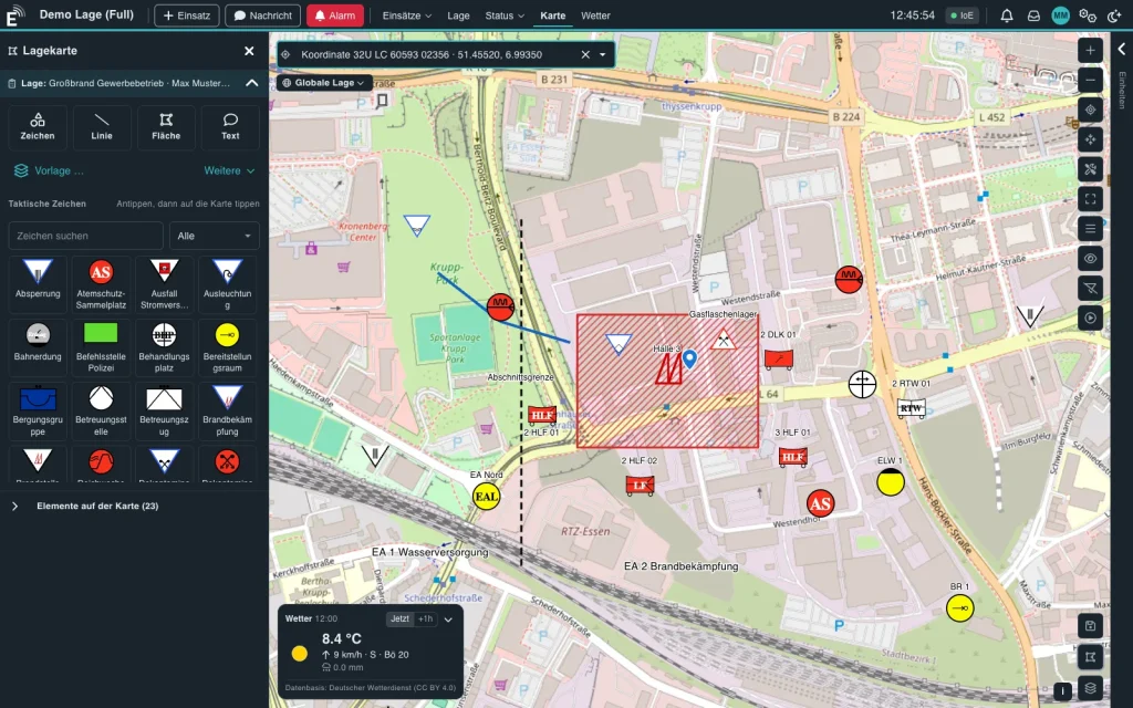
Stations, vehicles and incident locations on one map, status shown in colour – live and operable on a tablet. This is how you manage the situation with EMMA.
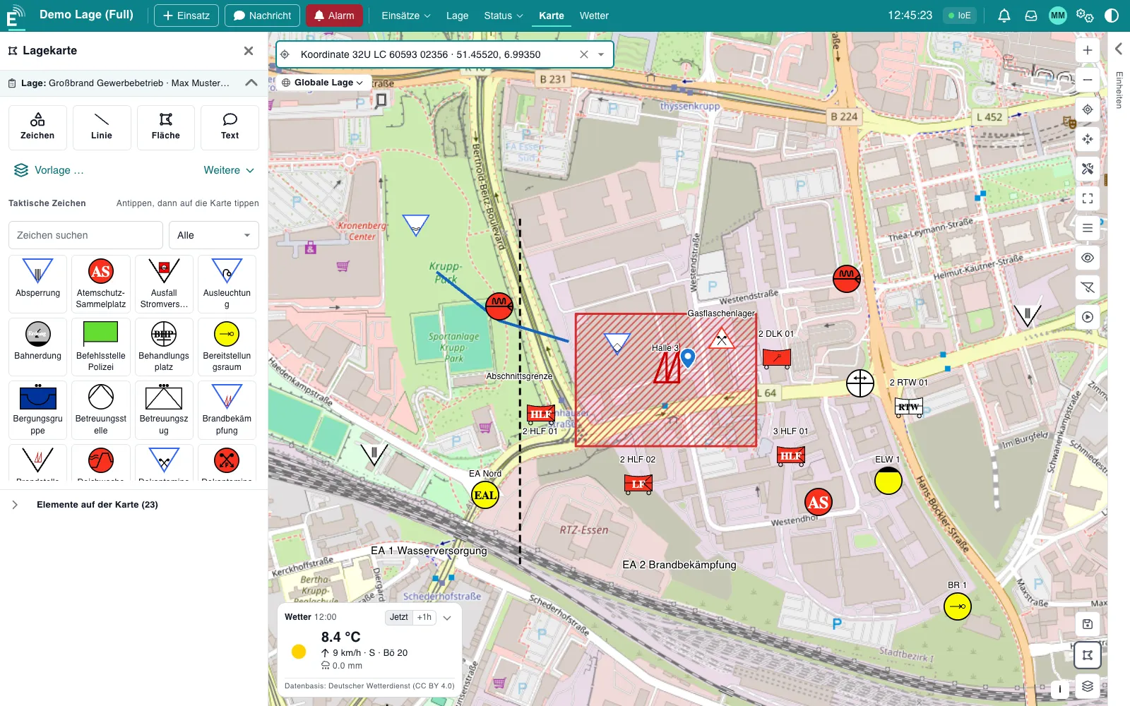
Managing an incident requires a clear picture: where are the stations, where are the vehicles, where is work underway? The tactical map in EMMA brings all of this together – live and operable on a tablet.
Stations, vehicles, incident locations
- Place stations: set the position once and the station stays fixed on the map.
- Assign vehicles: units are grouped by station, vehicles at a station are shown as one bundle.
- Manage the situation: incidents and warning areas are on the map, status arrives via TETRA.
Status in colour
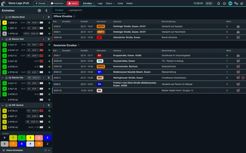
Every unit shows its status in colour – on the map and in the unit list alike. The situation can be grasped at once, even when things get hectic.
Draw and measure
The situation is drawn directly on the map and shared with every workstation – using tactical symbols according to DV 102, lines, areas and free text. Distances and areas can be measured and operational sectors marked.
Day and night
The light view is meant for daytime, the dark view avoids glare at night and in vehicles. It can be switched per workstation. A weather display with wind and precipitation is in preparation.
Would you like to see what EMMA would look like at your station? We are happy to show you.